 Photo: Jac on summit of Last Chance Mtn
It was very exciting times: I was going to do another section with Jac. This part of the trail crossed from Death Valley, CA into Nevada – fun to cross the state line. As it happens, I picked a difficult part to hike with one of the days involving lots of steep climbs and steep downs.
We met Jac at one of our previous re-supply points along a gravel/dirt road near an old mine (Big Pine Road) on Wednesday afternoon. The road was a bit nasty in the first half mile or so and then improved….23 miles to go on this road through a remote part of Death Valley. It is one of the only roads that leads out of the park in the north end. Along the way, we met a DOT guy grading the road, which was a good sign. It meant that the road was being maintained and would be passable. Parts were very smooth and other parts with more rocks or washboard. The final part of the route up towards the mine was a steepish windy way with high rock walls on each side. The top opened up with beautiful views of Death Valley floor and Eureka Dunes and the snowy High Sierra.
Jac arrived and we all camped up there. Our plan was to leave at 6:30am the next morning. I was a bit apprehensive about all of the climbing and ups and downs for the next day as I had not done much hiking since doing that last section with her. She is in through hiker condition now! But, Jac is being very nice about hiking my pace, which uphill means slow and pokey.
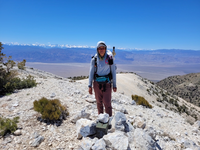
Thursday, May 7th we left camp on a beautiful cool morning. Jac was so lucky to get through Death Valley before the big heat arrived. The temperature was to rise to over 100. Our first three miles were on a jeep track and gradually went uphill. Not bad. The next ascent was also not too bad, also on more sketchy jeep track. We’d gained 1000 feet with not too much effort. But, the rest of the day was constant up and down with considerable steep sections including a couple of tricky downhill routes, especially on Last Chance Mountain – our high point at over 8400 ft. There was a register on top buried in a cairn and it was fun to sign my name there for posterity! Oddly, there were swarms of ladybugs – I had a hard time not swallowing any!
The views on this section of trail were magnificent. We could see how much snow was in the Sierra and then look down at the dry, dry valley floor. More wildflowers now too as we were gaining elevation and going into a different desert climate. Not too hot and nice breezes helped as the climbs were sweaty!!
By end of day, I was exhausted and flagging. But, we did reach our goal of getting over the long ridge we’d been hiking all day. We camped just short of Willow Spring and Cucomonga Road, the route that would take us over the border the next morning.
Friday May 8th started out again as a cool lovely sunny day. We checked out Willow Spring which was dry – we did not try to find water by bushwhacking into the willows – so possible you’d still find some deep in the brush! The first five miles on this day were on dirt road and jeep track, so fairly easy walking, though constant elevation gain.
Going up Cucomonga Road we saw many Joshua Trees and they were healthier than those in Joshua Tree NP. They must get more water up here. Lots of wildflowers and flowering shrubs again – fun to see so much variety of plant life again.
Some tricky route-finding today, but we were good about reading Steve Tabor’s guidebook to figure out the route in combination with our GPS tracks. Some of the route was up narrow canyon with trees and brush, so we wove our way around any obstacles. Lunch found us atop the White Cliffs – a dramatic high point with a plunging cliff down into a canyon below! Don’t get too close to the edge here.
Finally, we came to our long descent down canyon, which started out quite narrow. It was slow going because of all of the trees, brush, and deadfall that we had to negotiate. After what seemed like an eternity, the canyon opened up and it was clear sailing then. The canyon was lovely with Joshua Trees, blooming shrubs and flowering cactus. As we approached Highway 266 where Yeti would be meeting us, we were surprised how we could not see the road until we were almost upon it. A couple of cars went by and that’s how we knew the road was really there. Then, I did see the top of our white van and was happy that the day was over – I was tired.
We headed into Dyer and our little 2 bedroom house we had rented. It had a kitchen so I got some pasta, sauce, and salad fixings at the market and we were able to have a home-cooked dinner. Ice cream for dessert, of course. Got cleaned up and fed – what could be better. Thanks again to Jac for letting me hike with her – lots of fun.
Unfortunately, we had to move out of the house though we had hoped for another night. Through some mixed signals, the owner had rented it out unbeknownst to the RV Park and Cabin manager, so we planned to stay two more nights at the RV park. All of these things are right next to each other – Dyer is not big. Everyone here is friendly and nice, from the market ladies to Mr. Ed and Charlene, the RV park managers!
There is actually water in Nevada, so we probably won’t have to re-supply Jac on this section. We will meet her at Highway 6 and drive her to Tonopah, where she plans a day off. After getting her back to the trail, we will be leaving Jac. We got her through the dry California portion of the Desert Trail. Originally, Yeti thought he’d like to continue through Nevada, but his health issues are leading us home. While I am happy to be going home, it will seem weird to leave Jac. We’ve got a new friend and we’ll miss seeing her. But we’ll follow her hike and hope to see her up the trail.