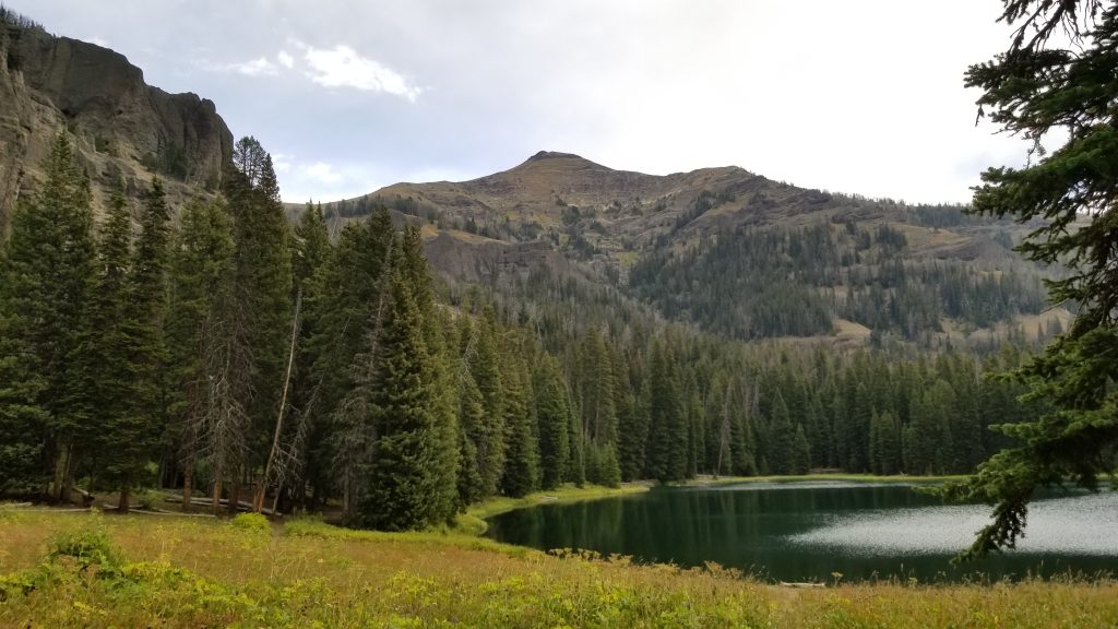
 Ramshorn Lake
Thursday, August 30
4.5 miles Tom Miner Basin Campground to Rams Horn Lake After spending the night at the Baker’s and a nice leisurely breakfast, we headed up to the Tom Miner Campground to get the trail. Fred and Julianne drove us up there. Due to the Bacon Rind fire, the GCT part in Yellowstone was closed, hence our starting point in Tom Miner. It was a steepish climb through a lovely “basin” or canyon passing by the interpretive trail at the Petrified Forest. No wildlife sightings except for B-Bar cattle! It sprinkled on us off and on throughout the afternoon, though the sun would come out in between the clouds. We reached the top after about 2 miles and had a break. At that spot, we turned off onto the trail towards Rams Horn Peak, shortly forking left on a path that began to go downhill. It was mostly through trees leading after a couple of miles to Rams Horn Lake where we set up camp. We played cribbage for a bit, cooked dinner, went for a walk up the hill, and over to the other side of the lake. Later, a couple came by for water; they camped at the first campsite – we’d considered that one but came along further closer to the trail heading north. The lake is a bit dark by late afternoon at this time of year. Rams Horn peak looms up over the water – quite a dramatic setting. We got into our tents early – before 8pm and then vroom! A few motorbikes roared up to the lake, stayed a while making some noise, and then roared off! Just enough to break the peace.
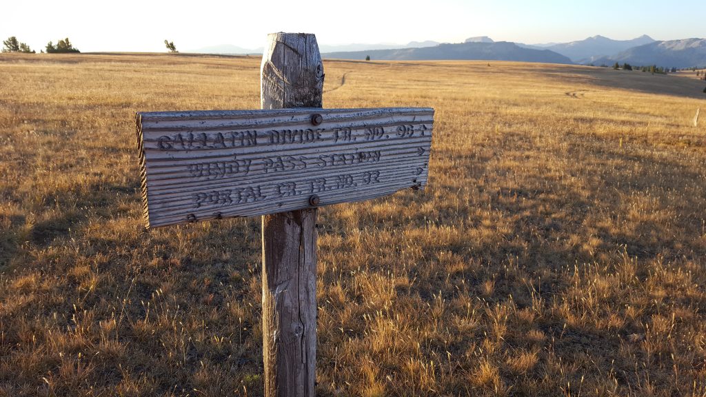 Old Gallatin Divide Trailhead Sign
Friday, August 31
9.5 miles to Windy Pass On the trail by 6:45am and heading up! Partly sunny, partly cloudy day today, which means a cool morning. We are all bundled up leaving camp. After about one quarter mile over the meadow, we cross a small stream and go steeply up in the direction of Fortress Mountain. The trail is eroded terribly in parts because of the motorbikes. There are really strange shaped conglomerate boulders all over – and Fortress Mt. is also dramatically shaped. We stop for our “breakfast coffee” just before topping the saddle. No goats this time – I’d seen a herd here in 2015. Downhill a bit and then up and down and over rocky and narrow ridges. It was very windy up on the crest, but great views. For the last few miles to Windy Pass, the trail moderates over grassy mountain. As we approach the pass and trail junction, we can see the cabin in the distance. Two hunters have the cabin and lo and behold, one of them is Yogesh Simpson, a musician Yeti has recorded. I’d not recognized him in his hunter camo. We camped in the trees a few hundred yards from the cabin – just where Julianne, Bob and I had in 2015. We also learned that there was a piped spring just behind the cabin. Played a bit of cribbage, ate supper, and hit the hay fairly early again. A good night here; comfy camp.
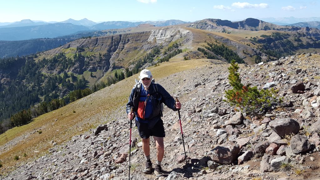 Yeti on the Ridge
Saturday, September 1
11.7 mi to Crater Lake Yogesh and his friend left really early at around 4am, before our 6:30 start. It was a steep climb back up to the crest, but then it moderated. Went to the top of the Sentinel and had to bushwhack back down to the path, as it skirts around the peak. Again, wind kept the morning quite cool. We saw many hunters, including a group on horseback. Yeti and I managed to find a spot out of the wind and we stopped and made coffee. A nice sunny day today, but we were layered up until the lunch break. This day was the toughest, with lots of ups and downs. But it is probably the most spectacular in terms of terrain. Unbelievable views of the mountains, including Big Sky and Lone Mt. Very rugged, long stretches of slabbing along the sides of grassy or rocky mountains, and a steep down to a meadow area just before a short and steep climb to Crater Lake. Crater Lake is a snow melt only water source, so best to stop at the small spring just before you do the final climb – watch for the spring on the left. The lake was really low. We camped in among the trees and had quite a nice sleep here. Yeti was exhausted, but I encouraged him to cook. We fell into our bags right after dinner – no cribbage this night.
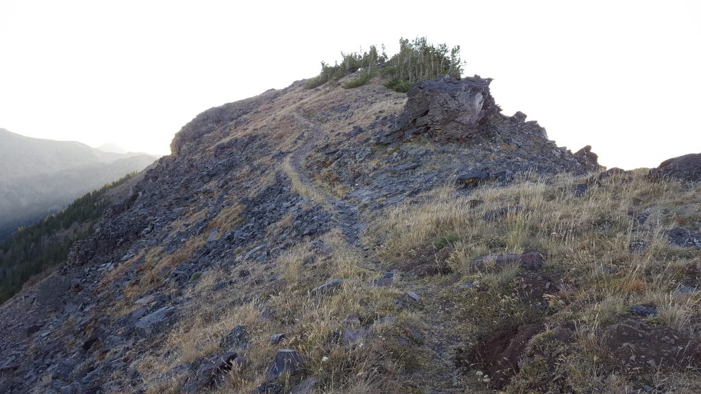 One of the Great Ridges
Sunday, September 2
14.6 mi to beyond Hyalite Reservoir, junction of Hood Ck. & Upper Wildhorse Trails Today, we got out even earlier – just enough light to see at 6am to pack up. Out by 6:30am. It’s a real steep climb of 500 feet just out of camp. Then, over a mile or two on narrow, even knife-edge ridges with steep ups and downs. Be careful on the gravelly downhills! It was very windy, so again we had on all layers until later in the a.m. where we de-layered. After several more challenging ridges we were back in the shade and didn’t suit up. We regretted this, as the wind picked up as we slabbed over to Hyalite saddle. Finally, near the top, I stopped to call Lauran to give her a heads up that we were on schedule for the next day’s pick up, we both put our jackets back on. Great view up here all around, including Hyalite Lake down below in front of us. That’s our direction. It’s a very steep downhill off the saddle for a short while into Hyalite canyon. Once we got down and we found some flattish rock, we finally stopped to make coffee. Now we started to see people all the way down to the trail-head. We pass over ten waterfalls, some really beautiful. My favorite was Chasm Falls; it drops down into a narrow rocky chasm as it flows downhill. Some motorbikes break the peace and Yeti took a photo of them. They were most likely illegal; and we think we were right once we got down and checked out the trail sign. We had lunch here and then off we went along the road, past the reservoir, and then off right on Hood Creek Trail. When we got to a creek by the trail junction with Upper Wildhorse, we stopped. We cowboy camped, not setting up tents, and had a nice night under the stars.
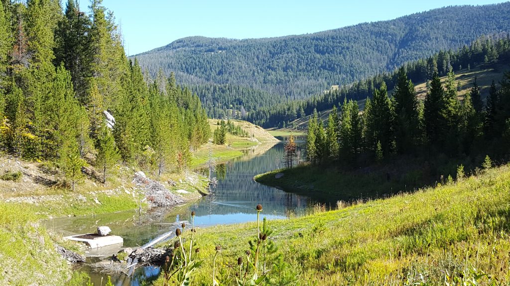 The Dam at Mystic Lake
Monday, September 3
11.7 miles to Bear Canyon via New World Gulch Trail Got an early start again and strode off confidently up hill on the Wildhorse Trail. We got a bit confused looking for our turn-off for Mystic Lake, both map and GPS were confusing or downright wrong! Luckily, a man and his son came along on ATV and motorbike. He knew the area and told us that we should have turned on the S. Fork trail – which on the map looked as if it just stopped and went now where. He told us there was a woods road at the bottom which we follow left heading to the lake. Good to know…glad we bumped into someone who really knows the trails there. Off we went, steep down with switch-backs for about a mile or so. It does end and what do you know at the other end it’s marked as Wildhorse Trail, the one we wanted. From here, it was woods road until the lake. Before we got there, we stopped in a sunny spot for our coffee/breakfast break. This is a nice way to do the morning: leave camp early and then find a nice spot to cook coffee. Now that we were not on thru-hiker mode, we had time to do this kind of hiking and we both liked it. Mystic Lake was a long, narrow lake apparently man made. There was a spill way at the one end and we marveled that the water line could have been that high – now the water was way down! The Mystic Lake Trail was nice – good tread, above the lake and went the entire length of the lake on the west side. We did see some people who had camped there, but it didn’t seem very crowded. Eventually, it led to our last trail into New World Gulch. This part was mostly wooded and also suffered much erosion from water and possibly bikes – kind of ditch-like a lot of the time. As we got closer to the bottom, we met more and more people. We made it to the parking lot by 1:20pm – just 20 minutes from our estimated time! Not bad. Lauran was there and drove us home! It was so nice of her and a big help to us. A great end to a great hike! This trail is highly recommended, and I’d do it again, no question. It would be fun to get the Windy Pass cabin once – it would require booking way ahead. Late August or beginning of September is a good time for it. Happy Trails!