Resuming the Desert Trail Wednesday, April 27, 2022
Yeti and I are planning to resume our interrupted trip. I will hike the second half (Oregon/Washington) with Yeti providing support. He'll re-supply me and pick me up at trail crossings, so I won't have to hitch. Whenever possible, we'll camp together if our meet is late in the day! Fingers crossed that Yeti's health permits. Remember, the L4L5 disc issue knocked him off the trail initially. He is doing PT for now for that. But, meanwhile, his heart issues reared up. He went in for a procedure called a cardio-version, where they stop and re-start the heart. It's done because it sometimes helps with a-fib. Well, things went south and he was transported by ambulance from Bozeman to Billings to have a three-wire pacemaker put in. Not fun. So, mid-May is our planned departure. We'll start in Denio Junction and I'll hike out from there. I'll be on the same route as the Oregon Desert Trail for a while. Depending on snow levels in the Steens, may have to be creative there. Lemstar
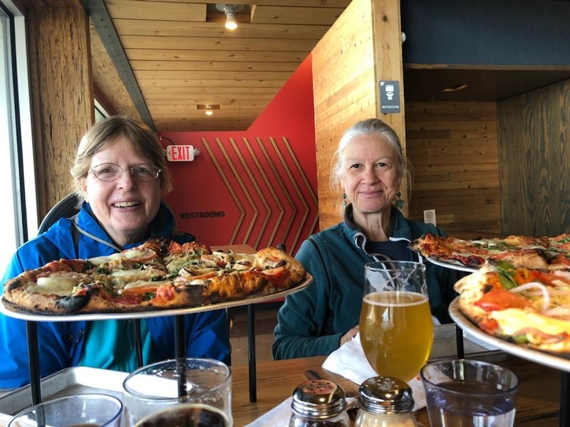 Lauran and Melanie at Mountains Walking Brewery
Pre-Trip Training Hike and Lunch Tuesday, May 10, 2022
I went up to Drinking Horse to do a quick training hike. It had snowed on Monday in Bozeman so there was now some melting snow/ice on parts of the trail. What a spring we have had; warm days, cold days and quite a bit of snow. That's good for our summer water needs and luckily most of the snow is high in the mountains. After doing Drinking Horse, I met Lauran (one of my BWAG hiking friends) and we did a walk around Story Mill into the nearby trails and houses. It was a lovely sunny day. We were to meet two other BWAG buddies at Mountains Walking Brewery in Bozeman for a last lunch before I leave for the trail. Deb and Gina met us there and we had a great Pizza lunch and I even had a beer (I'm not really a beer drinker, but when in Rome...). It was a really nice day. Practiced also with my new Garmin Inreach Mini 2. Our friend Mike is going to buy my old Mini. We are going to stay at his house in Boise Friday night and then continue on to Nevada where I will start the hike on Monday. Getting excited!
Lemstar
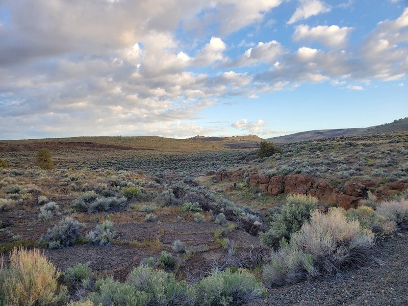
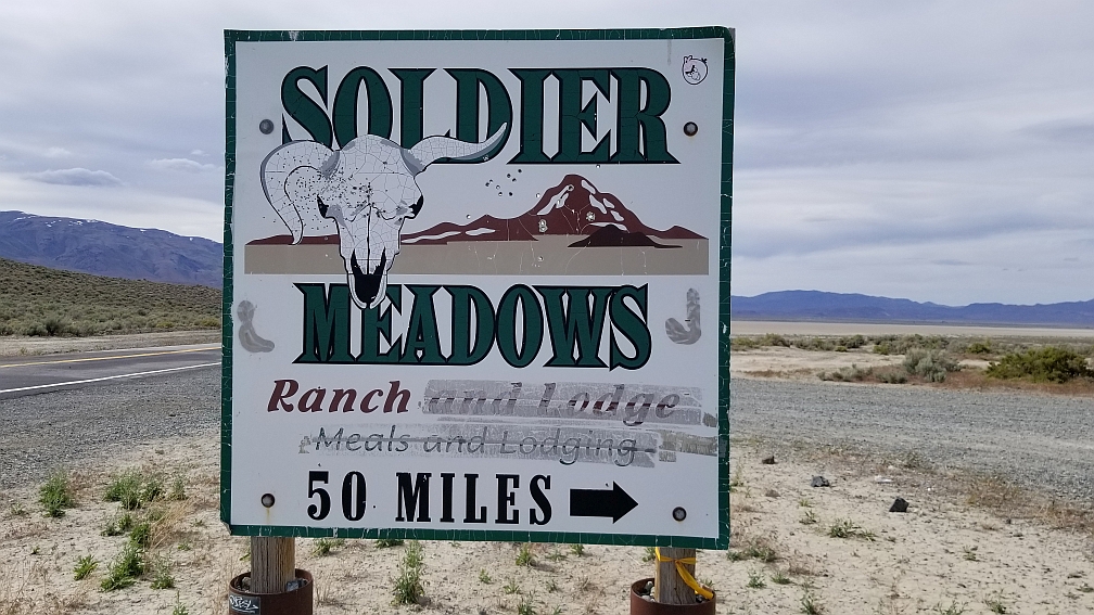 Soldier Meadows Road - Our Jinx Road
Cache disaster ... Again Saturday, May 14, 2022
Well, never a dull moment on our journeys! We had a fun time at Mike’s yesterday. Yeti helped Mike get started on his Inreach and did various computer things with Mike. I played with the dogs! Mike cooked us his famous Tamale Pie, which was delicious as usual. Unfortunately for us, Chris was away on a volunteer weekend for the Idaho Trail Association, so we didn’t see her.
This morning we headed out for Gerlach and to retrieve the last cache we had to leave previously. It was a long tedious drive to Gerlach mostly boring highway. The highlight was a stop for coffee in Jordan Valley, OR --- one of our favorite spots.
We got to Gerlach at about 2:15pm, checked into our room, but immediately went out to get the cache. It was 12 miles to the gravel road, Soldier Meadows Rd., and then 17 miles in. We hadn’t gone in more than 3 miles when the light on the dash came on signaling a low tire pressure. We stopped and sure enough, the right rear tire (passenger side) was soft. So, Yeti turned around and we headed back to town. But, by the time we got back to the paved road, the tire was clearly totally flat…and when we got out to look, we saw it was shredded! Couldn’t drive back to town. And, the Subaru only gives you those lousy donut tires as spares.
Because Yeti just had his pacemaker put in and his poor disk issue was just starting to get better, he didn’t dare try to change the tire. So, we called AAA (we have premium membership) and they said they’d send a tow guy within about an hour. The closest open tire shop was in Reno! Well….one-hour passes…then another half hour and they call back saying that they are having trouble getting a tow truck to come to Gerlach! Panic set in…would we spend another all nighter on that same road where we’d gotten stuck in the snow back in March? We seemed to be jinxed here.
Yikes. I had already called the lady who books the motel (she’s also a waitress at Bruno’s eatery) and so I called her back and she gave me the number of a local man who sometimes towed and had a local garage. Hip, hip, hooray for the locals! He answered and said he couldn’t tow, but he’d be right up and change the tire. He also said he might have a suitable normal-sized tire that would fit the car. With his power tools, it literally took about 5 minutes for him to put on the silly spare and we were headed back to town. And luck was with us, he had a tire. So, in about a half hour, we were back in business and back on schedule. I really thought the beginning of the hike would be delayed.
Yeti and I went over to Bruno’s and thanked the waitress profusely. We also met a really nice hiking couple from Redmond, OR….George and Mary, who invited us to have dinner with them, which we did. They were just out having a ball testing out a new camper. What a nice way to end a stressful afternoon. After all the back roads and dicey roads we’ve been on, I did not really worry about the gravel roads. Now, I’ll be a bit paranoid!
Needless to say, we are leaving the cache where it is. If I get to finish the Desert Trail (southern part) I will pick up the cache then. Off to Denio Junction in the morning, which is the starting point for my hike. We stay overnight there and I start on Monday morning. All’s well that end’s well.
Lemstar
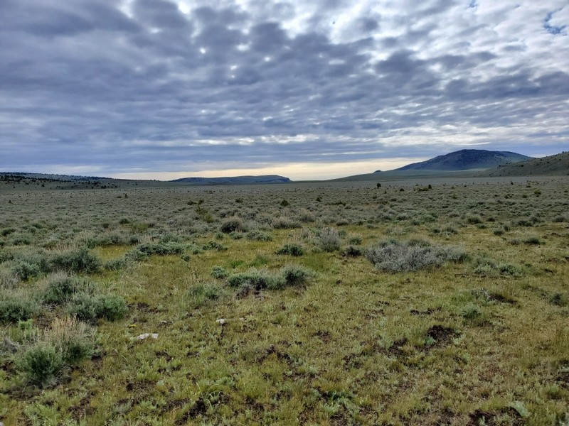
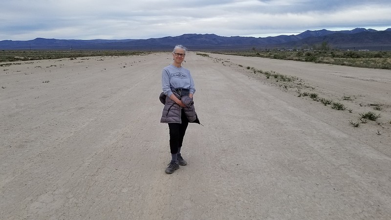 Melanie on Denio Junction Airstrip
In Denio Junction, NV Sunday, May 15, 2022
We drove up from Gerlach early, stopping in Cedarville, CA for breakfast at the same cafe we'd been to the last time through here. We were taking the longer way around to keep to paved roads. Got to Denio Junction around noon. It's a warm and sunny day - about 80 degrees with a strong breeze! As we approached, I could see the tips of the Steen Mtns. and there was a lot of snow there. I have already decided that I won't be doing the route over the Steens..way too much snow. I have an alternate from Buck 30 so I'll stick to that one, which is much lower in elevation. Unfortunately, the new owners of the motel and restaurant here are still waiting for their permits and can't cook food. So, we will go into Denio three miles from here for dinner. We have stuff in the cooler that we can eat, so it's not really a problem. But, tough for them as they lose a lot of business. I'll be getting my gear ready, do a final pack check, and hope to get an early start tomorrow. When we go into Denio we'll take a look at where I'll head up on my first leg of the journey. Maybe take a walk, too. We've been sitting too much in the car the past couple of days! We went into Denio for dinner at the Diamond Inn and had fun talks with Tiffany who is the daughter of the owners. She is helping her parents out for the summer, doing cooking, bartending, waitressing, in fact doing it all. Then we checked out where my trail starts, which is near the Denio Cemetery. And, finally, we did a walk behind the motel on the airstrip.
Lemstar
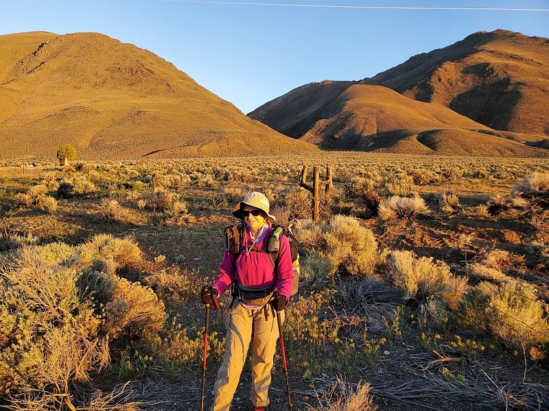 Melanie at Denio Creek Start
Denio Junction Trail Start Monday, May 16, 2022
We got up early so I could get a 6am start. Got to the trailhead which is by the Denio Cemetery (after a road section from the Junction) and took a photo, gave the Yeti a kiss, and off I went. I was planning to do Buck 30s alternate up the ridge because the original route along Denio Creek was choked with vegetation. Hey, just like Carrizo Gorge in California! The Oregon Desert Trail Association has moved the original route to a wash just east of the original, which I could have done and which would have been the easier option. The over 2000-foot climb was pretty brutal, especially since I was not in thru-hiker condition. It was steep and in the beginning on difficult ground, soft earth and pebbly, so my feet kept sliding around. I could see the drainage where the new route was and it had vegetation too, so I wonder if in a few years it may be impassible too! Near the top, I joined a jeep track that came out of the wash and that made for easier walking. It was kind of level for a short while and then descended on the other side of the ridge. The next section was also very hard for my tired legs. The route led over small drainages or dips, so I was constantly going up and down. I find this more tiring than one longer straight up! Terrain was typical desert stuff with sagebrush, prickly brush, and delightful wildflowers (including Larkspur and Arrowleaf Balsamroot)! I saw my first paintbrush here. And, four snakes! Three were definitely rattlesnakes, but not sure of the other one. It was so small and slithered away so I couldn’t tell. My mileage average was pitiful: one mile per hour! No 25-mile day today! I managed only 13.8 miles. After the ups and downs, the “trail” started to do more serious climbing into the Pueblo Mountains. Ultimately, I climbed up over 7600 ft. The tread was okay, no trail but not too bad bushwacking. Lots of contouring once one got up high. Sometimes I was up on the crest too, but usually it would drop down a bit again and the side-hilling continued. Views were great though and glimpses of wildflowers continued. I was thrilled to see the flowers, even in such dry territory. There were blobs of snow up here and I did have to put on the micro-spikes on one steepish section. The snow was quite soft as it was late afternoon, so I walked without spikes over most of the small snow fields. I hiked until 8pm and was still high up. I found a rock formation where I could be a bit protected by the wind and cowboy camped (lucky for me no rain). Made a hot meal and then crashed for the night. I was very tired!
Lemstar
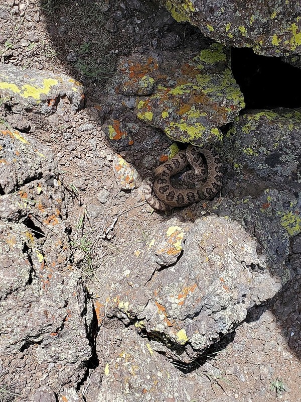 Rattlesnake
Fields Station and Borax Lake Tuesday, May 17, 2022
Happily, it was a much easier day today for my tired feet. I got up and going by 5:20am…nice that it gets light early now. I continued on the ridge up high with fab views. I was quite sure I was seeing Borax Lake and the Alvord Desert, where I would walk after reaching Fields Station. The ridge got to a small knife edge that I had to scramble over, but for the most part was pretty good walking. And, thanks to the Oregon Desert Trail Association (I think) there were large cairns along the route. I did get out the spikes again to cross snow, which overnight had hardened. I was glad that I’d taken the micro-spikes which made going over that snow much easier. After a few miles, the route started to descend through dry scrub and the usual sagebrush. There had been plenty of water along the way, so it was not necessary to carry a heavy load. After a couple of miles I joined a jeep track. I could see a ranch ahead, but the track didn’t go that close to it. The next stretch was lovely. A long grassy meadow yielded more wildflowers, and I saw my first deer. What an easy morning. I was doing better mileage too on the jeep track and it would take me to the paved road, where Yeti was to meet me. Before reaching the road, I saw a vehicle approaching. Yeti had driven in a bit and so off we went to Fields Station, which was a great oasis. It has a small store and a nice café. They also have a two-room motel! Yeti had had morning coffee there and while he sat drinking his brew, three small one-engine planes landed on the road! The pilots came to sample the Station’s great breakfasts! Yeti chatted with them and when they were ready to leave they asked him to drive up and block any traffic on the road so that they could take off! I kept thinking of my friend Gina’s husband who flies…though I think his plane may be bigger. Not sure if he could land on a two-lane road. I enjoyed a couple of hours rest and we both had the famous milkshakes Field Station makes. Yeti and I both had a Blackberry shake and it was GOOOD. They give you the whole metal container that the milkshake is made in and it was thick. You needed to eat it with a spoon! Yum. After filling my water bottles and getting more supplies, I continued on the trail to pass Borax Lake. The area is so dry, it is also covered with white alkaline crusted surface. Surprisingly there were spots of marshy, watery terrain that attracted birds. And it was flat! After crunching along the white crust, I had to cross a dry lakebed (Alvord Lake). Unfortunately, because I made a mapping error, I missed Dixon Spring, so I had to be a bit careful with water. I camped at about 7pm without tent again. Moonlit night and quiet.
Lemstar
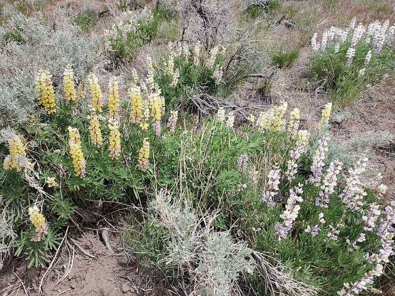 Yellow and Purple Lupine - Wildhorse Road
On the Alternate Route around Steen Mtn Wednesday, May 18, 2022
Because of high snow in the Steens (9500 ft), I was walking an alternate routed by Heather and Buck 30, which turned out to be great. It was much lower down. I continued through the Alvord Desert mostly flattish winding my way through the sagebrush. You can’t walk a straight line here, you weave around finding the path of least resistance! After a long period of flat the route climbed over a couple of knobs. On the crest of one of these I came across an odd sight: a huge trailer with two small sheds out back and a wooden deck! Everything was shut up tight. There was a pump out back which I tried hoping for water, but no go. I discovered a generator in one of the sheds, so probably the water pump needed the generator to work. I took a break here marveling at how anyone got such a huge rig up to this location and what it was for…maybe a BLM outpost? Views here were terrific of the Alvord Desert behind and the mountains I’d be heading for in front of me. I soon reached East Steens Road after hiking down a wildflower packed hill. I saw paintbrush, phacelia, daisy-like flowers and lupine. The road began my alternate route around Steens Mountain, where I could see the snowy slopes. After two miles, I turned onto Wildhorse Road, which wound through private property. Buck 30 had mentioned having to go through gates posted as private property. I called BLM before the trip and they assured me that this road was an access road to BLM land, so I was fine as long as I closed gates and stuck to the road. I’m sure the ranchers might not agree. This happens a lot, where public road goes through private property and the landowners block it off. Anyway, I didn’t see anyone (and they didn’t see me) even though I passed by two houses quite close to the road. Plenty of water up here with nice snow melt flowing streams. I filled my bottles so I could make my hot lunch. After passing the last house, the route turned onto an abandoned jeep track. I walked in a bit and was starving so I settled down for my meal. Just as I was setting up my stove, a white pick up from the last house passed by on Whitehorse Road. Great timing for me, I just made it out of sight in time. Delish Pack it Gourmet Pasta Puttanesca for lunch … it was yummy. As I was sitting there, my Garmin InReach chimed indicating a message. It was from Yeti and read “check phone messages.” I turned on my phone and had bars! There was a text from Yeti telling me not to head to the creek crossing that was on my route as it was very high and running fast. He was suggesting that I bushwhack to the main route and use that crossing which was only about knee high. So, I shot a message back “ok”. What luck to have cell reception and the Garmin minis. I’m tracking with the InReach which sends data to my MapShare page so that folks can follow my progress. And, each night I send a preset message that all is okay and I’m in camp. We used to eschew these devices, but with Yeti as my resupply buddy, they really come in handy. Yeti was going to meet me at the crossing and help if needed. Next came a 2300-ft climb, which was made much easier with the jeep track. It got obscured here and there but lasted all the way up and actually was there for my entire route to the spot I was to meet Yeti the next day! I huffed and puffed up the mountain (don’t have thru-hiker stamina yet) and had great views back to the lovely canyon that I had just walked up. The lupine there had been beautiful and in two colors, purple and yellow. Finally got to over 6900-feet to a plateau still using the jeep track. It was lovely and the only thing that wasn’t good is that the wind was so strong it almost blew me over. There were snow fields a bit higher up over 7000-feet, but I didn’t have any on the plateau. Plenty of water too for the rest of the day. This was a great route, I commend Heather and Buck 30. It was pretty, easy hiking and a joy. After the plateau, the track gently descended and small trees started to appear. Clearly, I was changing into a greener area, still desert-y but not as dry as Alvord Desert! After reaching 20.6 miles I stopped to camp behind some trees that help block the strong wind. Cowboy camped again! A great day and it meant that I had only about 10 miles tomorrow. I was worrying a bit about the bushwhack, as I did not know what the terrain would be like.
Lemstar
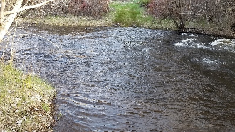 Original Crossing of Big Indian Creek on Alternate Route - Waist High!
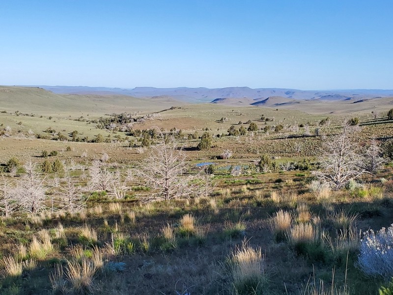
Jeep Track to South Steens Campground Thursday, May 19, 2022
Got an early start and continued on my great jeep track as it gently descended. More and more trees dotted the gentle hilly landscape. It was a big contrast to the dry terrain of the last days. There was one more short stretch of private property I didn’t know about, but no one in sight and I was through that in about 20 minutes. I stopped for a breakfast snack and actually made some coffee, so I could check the map and see where my bushwhack would start. I had two alternatives and chose a route that started on a jeep trail. It looked the shortest. When I got to Mud Springs, the turn came. The jeep trail was long gone, but it was a nice gentle way up. Great to have GPS that showed the turn as the jeep track was long overgrown! I was using Backcountry Navigator on my phone for this stretch as the GPS map didn’t show the jeep trail. After about 20 minutes, I had to bushwhack more north to reach a final steep down to Indian Creek. It turned out to be an easy bushwhack, nothing too brushy except a bit at the very end. I could hear the Creek roaring as I approached and was hoping the crossing wouldn’t be too hard.
Got down to the Creek and saw where the trail crossed and it didn’t look too bad. I sent Yeti the preset message we agreed on, but didn’t get a reply as he was already hiking in. I waited there 30 minutes and realized I could make it over alone, so I did. I chose to angle over to some small trees on the other side a bit higher up from where the trail met the creek on the other side. Even though it was only about knee deep, that water was MOVING FAST. I never underestimate the power of moving water…it was not that easy. I used all my energy to remain standing and was literally one step from the bank when my right foot slipped on a rock. Luckily I grabbed the small tree branch, though I still slipped over to the right and got wet on that side. If I hadn’t grabbed the tree that water would have sucked me downstream. And, it was icy cold. I changed into a dry shirt and didn’t warm up until I got to the campground where I changed clothes.
About 5 minutes up the track, I met Yeti! The day was quite cool with a strong breeze. Lovely area, meadows, trees, an actual trail to South Steens Campground where Yeti had stayed a couple of nights waiting for me. Yeti has a booster in the car to enhance cell service and that is how he had been able to send me the warning about the creek crossing. I’m impressed with how well it is working. Saved my butt. If I had continued to the original crossing, I probably would not have made it over even with Yeti’s help. It was waist high or more and raging there. I am skipping the next section here as it would involve three more crossings of bigger creeks and rivers, so no way was I doing that!
We were intending to stay in Frenchglen, but the hotel and the resort was full of birders! We stopped in Frenchglen for coffee and then drove north to Burns, OR. This is the advantage of having a support team with a vehicle! Boy was I happy to get clean. I was a mess, dirty and tired. I was a day ahead of schedule, so I decided to take a zero. I will be in Burns again at the end of the next section, as well.
We had a great lunch at El Toreo Mexican restaurant and then checked into the motel. We did laundry, which was 2 miles from the motel and then got some supplies at Safeway for our light supper of bread and cheese, wine, and grapes. My hiker appetite has not stoked up yet; it generally takes a few weeks before I am ravenous and able to eat everything in sight …. followed by a pint of Ben & Jerry’s!
Tomorrow I’ll take care of other hiker chores, including writing this journal and naming pictures.
Lemstar
 Amazing colors in Malheur Wildlife Refuge
Into the Malheur Wildllife Refuge Saturday, May 21, 2022
I did Buck 30's alternate through the Malheur Wildlife Refuge to avoid any contact with the private land on the east side of the Refuge. Although the Desert Trail has an easement, it abuts the properties of the folks like Bundy who held the BLM hostage here. The Refuge was full of birds...too bad I'm not a birder. Frenchglen was full with birders. I did see a white egret, lots of ducks, redwing blackbirds, and an unusual bird with a yellow-gold head and shoulders with either a brown or black body. Also saw a small yellow bird...goldfinch??? I needed Val and George here; they are bird people and would have known! Easy terrain here, flat gravel road. Lovely marshes and ponds and lots of birds obviously. A nice route altogether. But,I had a stupid mishap which cost me time and some miles. I actually missed a turn. And, I was looking at the GPS thinking I"m following the Blue alternate track. It turned out I was following a river, which is also blue! I used Backcountry Navigator on my phone to bushwhack my way back to the trail! Man, I was kicking myself for such a silly blunder. Some road walking including paved road. There were farms here, so I knew some of the land was private property. Only saw one pick up truck on this road. Got water at McCoy Creek and did a few more miles, stopping to camp when I knew I was on BLM land....Diamond Crater.
Lemstar
 Morning View Diamond Crater BLM Land
Gentle hills and jeep tracks Sunday, May 22, 2022
Great morning and scene over Diamond Crater land. I still had a few miles of paved road before heading cross country up a hill. Today's hike was over gentle buttes, walking jeep tracks and going through cow country. A surprise awaited: Yeti met me on a gravel road that he'd been able to get in on. It was a nice meet, as I was almost out of water. Coming down the hill I was among a big herd of cattle. A cow pond below was a possible source of water but the herd was congregating there. But then I saw the car and I figured it was Yeti. Lucky break for me. We had lunch and then I carried on. We decided we'd meet at Hwy 78 and I would spend the night there at Yeti's camp at the Crane cafe. The rest of the afternoon was a combination of jeep roads and climbs. A steepish climb up Riddle Mountain provided views of the surrounding dry, sagebrush country. I was heading to Buster Creek where I'd get water. When I finally got there, the creek bed was dry. I was tired though so I camped there anyway. A black cow had been around and running away from me. I think I camped fairly near a cow pond and it must have been his territory. I heard some snuffling during the night, which must have been my cow! He must have been made at me for being in his patch. Otherwise passed a pleasant night.
Lemstar
 Sagebrush Flat
Sagebrush Flat Monday, May 23, 2022
Got up this morning and my cow was nearby bellowing at me. He was glad when I left. Maybe he was calling out to find others of his kind, as he was a lone wolf. The route took me down to another part of Buster Creek and there I found water! I filled my water bottles and headed out. I was planning to go out at Hwy 78 where Yeti would meet me. It was a chance to camp together; he was camped behind a cafe near Crane, OR. He'd been having a lot of fun with the owner Tom and all of the staff there. He also ran into Crimson and her husband up at the bar there...she is the Burns BLM person whom I'd spoken to before we left. I'd inquired about conditions around the Steens Mtns. What a coincidence. Gentle butte climbs, and then crossing Sagebrush Flat. The name says it all. At first, it was not too dense, but as you get further into the flat, the sagebrush is so dense you are basically walking over it. Slowed me down quite a bit. A steepish climb up another butte, where I got great views of the Flat and valley ahead. Cows, cows everywhere and some cattle tanks and ponds. A few more ups and downs and I could see Hwy 78. A gleam in the sun was our car. I had a view of it for just a moment when I was at a high point, but then descended into trees. A few miles and there I was with Yeti. Unfortunately, I'd missed the grill at the cafe. But I did have two cold beers. I don't usually drink beer, but after a hot day it does taste good. Yeti had set up his rainbow tent, so I used that. He always sleeps in the car! Would get up early next day, so I could have my usual 5:30am start.
Lemstar
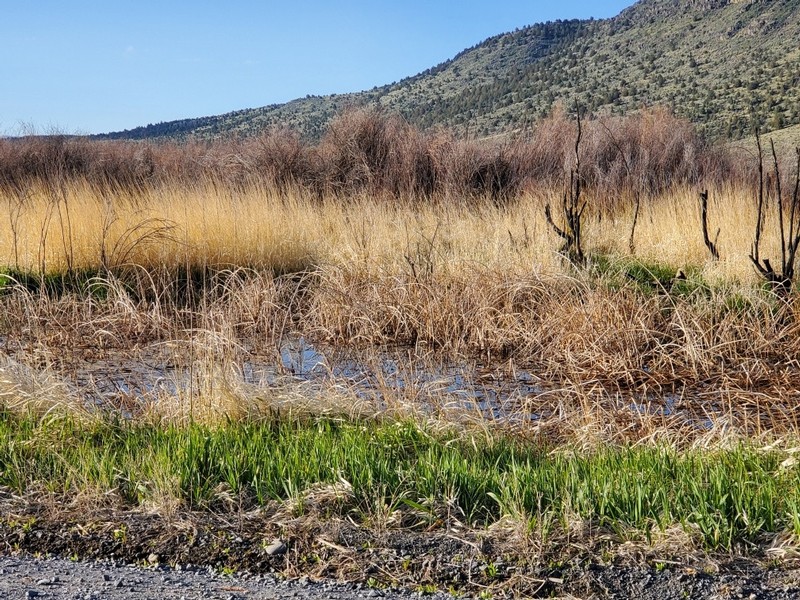
 Antelope Spring after Hwy 78
Cross Country from hell Tuesday, May 24, 2022
Yeti got me back to the trail early. It started really nice on jeep track passing the wonderful Antelope Spring. I didn't need water though so I just kept going. I was going to do two blue alternates that would be a bit shorter than the main route. That said, you never know if "short cuts" end up being time savers. The first alternate involved quite a climb up a butte with lava rocks. Once higher up, I noticed a game trail and followed this route into what I am referring as HIdden Valley. It was a narrow valley through an obvious burn. Wildflowers were carpeting the ground as is often the case in a burn area. It ended up at a pass where I rejoined the main track. I had lunch up there with great views. The second alternate gave me an introduction of what was to come; lava rock hell. It was a steep climb up and down to Coyote Spring. I was relieved to see the spring, which was dry, on a nice green flat, so I though I was home free. Soon, however, the rocks began. This cross-country was truly hellish. Boulder fields of lava rock of varying sizes. Progress was excruciatingly slow...and my ankles kept rolling. Not good. So, I slowed down even more. It took me hours to get through this section and I was almost in tears when I'd see more fields of rocks! It was almost getting dark when I finally reached a game trail that was not rock filled. I followed it out to the jeep trail. I almost kissed that ground. It was pretty late, but I was determined to go further on the jeep track. I took out my light so I could see the GPS. After a while, though, the track seemed to disappear. It looked washed out. I could not see enough and didn't want to go astray, so I set up camp. Exhausting day.
Lemstar
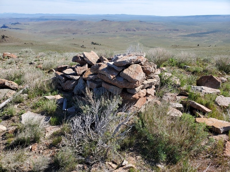 Cairn and View from Swamp Creek Butte
Over Swamp Creek Butte Wednesday, May 25, 2022
My left ankle was trashed and quite painful this morning. I gobbled ibuprofin and started slowly up the jeep track ... it had been washed out in the section where I camped. Finally, as I warmed up my pace improved, but it was going to be a tough walk. Today was both jeep track walking and cross country with climbs up various buttes. I was pretty slow on the cross-country, but luckily none of it was that atrocious lava rock. When I finally got to Swamp Creek Butte, I had great views all around. There was a big cairn on top, so obviously people do walk up here though there is no trail. I had decided to do a blue alternate which was all on jeep tracks instead of the main route which would have been all cross country. I'd never get out that day if I did the cross-country. Yeti did message me via the Garmin mini to tell me to do the blue route. The jeep track was pretty rough at first, but then turned into a good dirt road. Lots of cattle again! At a gate further on, Yeti met me and we headed out. Disaster struck - a light on the dash flashed on indicating low tire pressure. Not again! Yes, the rear tire on the driver's side this time was going flat. We had to change the tire. Luckily Yeti knows how to do these things. Getting the jack on the car was not easy...they give you a stupid "donut" tire and the jack is not the best. But, in the end, it didn't take that long to do the job. Kudos Yeti and we were back on our way . We took Hwy 20 back to Burns. We stopped at an outpost in Buchanan on the way to have lunch. Then back to the Days Inn where we had stopped before. We went to a tire place to try to have the tire repaired and it was a bad flat. Yeti decided to replace all the tires...something we were going to do when we got home anyway. That's two flats on this trip! The other tough thing was that we both ended up having a terrible stomach virus. Yeti mentioned to me that he'd been really sick the day before he met me. We thought it was food poisoning. But, then back in Burns, I began to have the same symptoms. Had a terrible episode with that bug. But, started to feel a bit better by late evening. What a day! My ankle was pretty bad and it looked like tough decision time. I really could not walk on it. It's looking like the hike is over for me. Ah, rats. I really hate to give up, but it will take weeks for this to heal.
Lemstar
Post Hike Blahs Tuesday, May 31, 2022
We are back at home again. Yeti and I traveled back on Saturday and drove straight through. We did go to the Austin House Cafe in Bates, OR to pick up the one box we had sent ahead and then headed home from there. Mike had suggested we stop in Boise if on the route - it was - but we didn't dare risk getting MIke or Chris sick in case we were still contagious with this stomach flu. Yeti also thought it could be Covid. So, we did not stop in Boise. Sunday morning we trooped over to Belgrade Clinic and had them look at my ankle and give us both Covid tests, which were negative! They gave me an enormous boot to use for my ankle; I only wear it if I am going out not in the house just sitting around. I call it the Frankenstein shoe. Today, it felt a bit better. I could at least stand up on the left foot without excruciating pain. It's been wet since being home and everything looks green. That's something to enjoy while it lasts. Flowering trees are coming out. Can't wait for the foot to heal so I can resume day hikes. The next month is great for wildflowers. Well, I have to figure out my strategy for building up my ankles and how to finish the Hayduke successfully. Lower miles, ankle high boots, and strength and balance exercises for the ankles are on the horizon. I"ll do whatever it takes to finish that trek. Looking forward to a hiking season - luckily I"ll be able to still day hike and do shorter backpacks...there's lots to do. Would love a trip East, but still not willing to get on a plane, especially since they have eased up on mask wearing. That in spite of higher Covid numbers than last year! Yeti and I will continue to be careful, so lucky we love the outdoors.
Lemstar