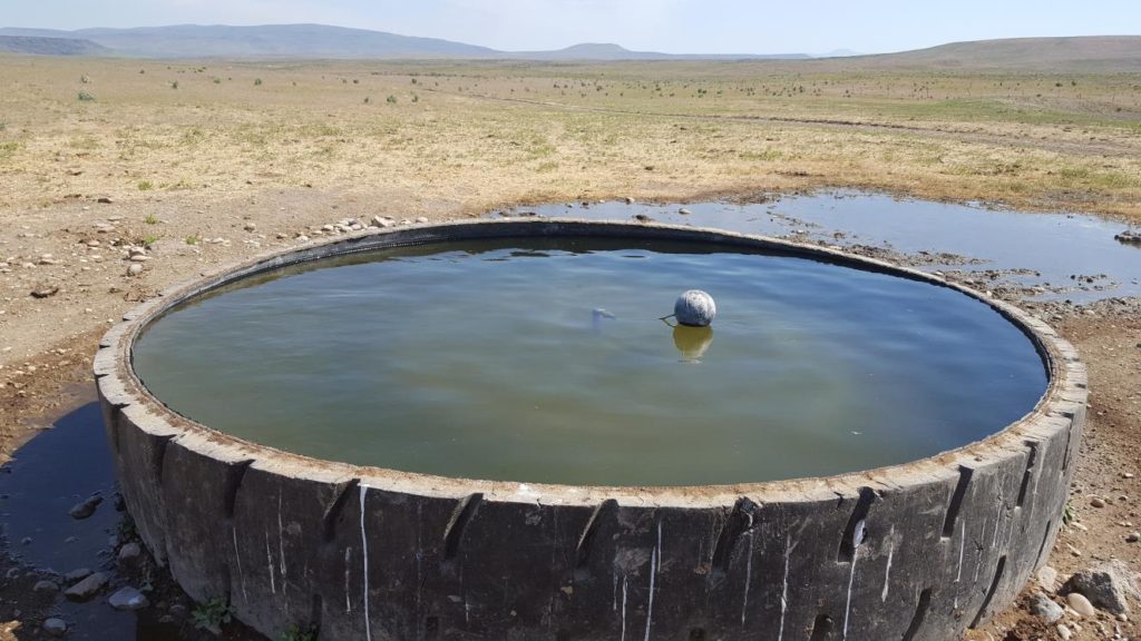
 Cowgill Well
This is from Melanie's trailjournal.com site. If you want to read more, go to our journal sites below: Melanie's IBT 2016 Journal: http://www.trailjournals.com/melanieibt2016 Yeti's IBT 2016 Journal: http://www.trailjournals.com/yeti2016
Below are excerpts from the journal:
This is Cowgill Well after going over Mahogany Mountain just north of Jordan Valley, Oregon. This was a very dry area & when I went through here in 2013 the well wasn’t working & I could not get it going. The last part is through private land but they don’t care.
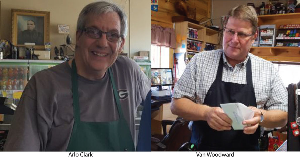 Arlo Clark (Oakly) Mail Delivered to Van Woodward (Weston)
The “Hikers Express” on the IBT
Arlo Clark (Oakly) Mail Delivered to Van Woodward (Weston)
The “Hikers Express” on the IBT
On the Idaho Boundary Trail when you arrive in Oakley, Idaho for resupply, at Clark’s Market the owner Arlo Clark who is a very friendly guy has a friend named Van Woodward who owns the Woodward’s Country Store in Weston, Idaho which is the next stop where you can get food and ICE CREAM! In 2012 Mike O’Brien met Arlo and he asked Mike if he would take a note to Van. Of course Mike did and Van really was really surprised and had a good laugh. I knew about that so in 2013 I asked Arlo if he wanted me to take a note to Van for him again. So I did. The Mike did again in 2014 and Melanie and I did again in 2015. We are now called the “Hikers Express”. It’s good for a laugh and a free ICE CREAM Bar! Now it’s a tradition.
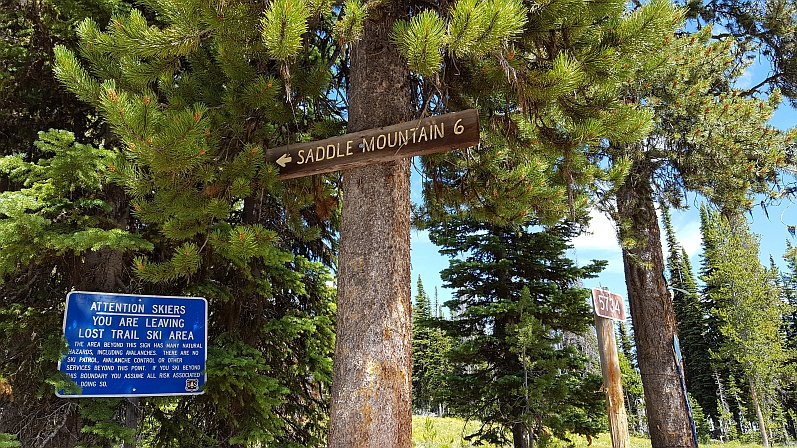 Saddle Mt Trail Sign
Lost Trail Pass to Lochsa Lodge
This is a section of the IBT I had to skip in 2016 because of fire closure. Blog entry follows.
Aug 2,3,4: Lost Trail Pass to Hamilton
We stayed over Wednesday night in Darby at the Mountain Spirit Inn. Thursday morning, we left early to drive to Lost Trail Pass where Yeti and I headed up the steep Ski Trail into the woods. It’s the same route initially for the IBT route that goes back to Darby via Nez Perce Pass, but I’ll diverge and begin to go more northeasterly towards Hamilton. Yeti came in about 4.5 miles and turned back; I went on along the road and shortly turned off onto trail 171 which I’d use for the entire day. I was lucky as most of the climbing was the part in the morning. Most of the rest of the day the terrain was moderate, though open to the sun. I slabbed along mountain-sides, passing fields of wild flowers. Views of the valleys were somewhat obscured by smoky haze from fires. I didn’t see any other hikers. By the late afternoon, I started down toward Hwy 93, where the campground was and expected to run into Yeti at some point. I had the downhill; he had a steep climb. We met a couple of miles from the road and hiked back down to the campground. It was on a river and very nice. I pitched my tent, got cleaned up, and since we had a car we drove to a restaurant and had a great meal. In the morning on Friday, Yeti and I headed out directly from the campground. The route took us up about 1,000 feet on a woods road. Great views back of the valley and the mountain I’d come down the day before. It was a steady climb for several miles. We branched off onto an old jeep track heading up a ridge. Across the way, we could see an old fire look-out cabin. Yeti again came in about 4.5 miles and then we parted. He would go around to the Hamilton side, find a campsite near where I’d come out, and meet me tomorrow on the trail. I continued up the track. Lots of views into the valleys on both sides of the mountain once I got to the top. I then headed downhill on FS road moderately for several miles: I could see the road snaking around; it kept curving into canyons, so the distance was more than it looked. Again, no sign of people. Hot day again and I was grateful for any shade. I did pass some homes after leaving the National Forest and before doing another gradual and relentless climb on gravel road. I decided to stop to make dinner at about 4:30pm and then hike on, which I like to do sometimes. It gave me a break after a long, hot exposed climb and energized me so that I could do some more miles. I did a big day, over 25 miles, I think. Camp was a big turn-out along the road. On Saturday, I got up early and figured I had one small climb. But, after just a very short while I started to descend – so I was further than I thought. So, I had a very pleasant morning hike – downhill all the way on FS road, and I did great miles. Mostly views of trees, quite pretty. I stopped mid-morning for a longish break, made coffee, and enjoyed the early sunshine. Before long, there came Yeti; he’d gotten up early and hiked in several miles already. We figured we’d get to town early enough for a late breakfast! He’d found a great campsite by the river just near where the road I was hiking came out. We drove to Hamilton and it was too early to check into the motel, so we went to breakfast and then read in the library. That evening, we had a good supper at a wine tasting room. BC Winery – local stuff and it was good.
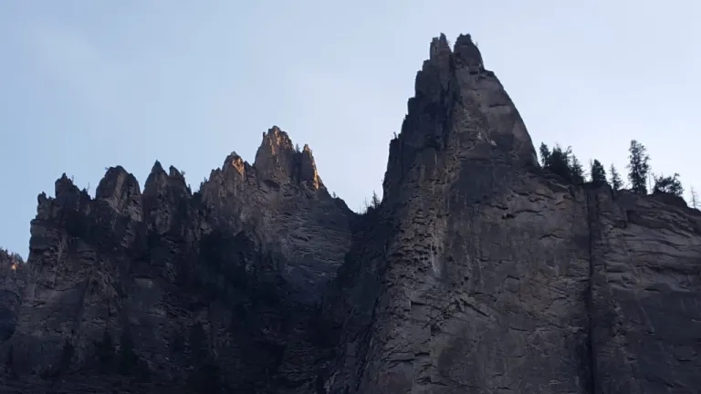 Ridge After Leaving Hamilton
Aug 5,6 Hamilton to Lochsa Lodge
This was the last stretch, about 46 miles to Lochsa Lodge and would be more challenging terrain. Sunday morning and we drove from Hamilton to Blodgett Creek trail-head. There was a campground there and several cars in the parking lot, so I figured we see people, which we did. The trail climbs up a narrow canyon along a creek, has several picturesque waterfalls, and is rocky. One of the hikers coming down the trail had seen a bear and though we saw quite a bit of scat, we did not see any bears. Yeti turned around at the 5-mile point and I soldiered on. Trail conditions were not great – very overgrown in parts and I made slower progress than I’d hoped. By lunch, I doubted that I’d be able to get in 25 miles that day, which is what I’d hoped to do. Finally, I left the overgrown trail and in mid-afternoon heat started the steep climb to Blodgett Pass. Though a hard grind, I enjoyed it more than the more level last miles, as it was not overgrown with vegetation and I had great views of the long canyon I’d just come up. Again, I stopped to cook on the way up, so that I could then just hike until almost dark. Glad I did that. Was I glad to get to the pass and it was worth it. It was stunning with dramatically shaped peaks on both sides. I still had another climb up to Frog Lake and encountered a blob of snow on the north side. I was glad to be going downhill and it was already late. At this point, I hoped to be able to eke out a 22-mile day, which in fact is what I ended up doing. I went as late as I dared, stopping in a burn area at about 9:15pm. I was beat. Got as early a start, but I needed to be able to read the GPS as burns tend to obscure trail. The going was good for about an hour – got to the junction where you would go right to ascend to a cabin on Lookout Mt. I proceeded on and then came the burn area from hell, deadfall and no trail. Thank goodness for the GPS. This slowed me down, because I was basically navigating solely using the GPS. Every now and then trail would re-appear. Finally, after a couple of hours, I crossed a creek and was on more stable trail, or so I thought. Now and then deadfall, but it seemed okay. Then, the trail got rougher with many more downed trees and sometimes overgrown trail and downed trees. I was getting anxious, as I had more miles to do than expected and figured I’d get out later than planned. Yeti would end up having a longer wait at the other end. It was a frustrating day; slow hours of climbing over trees. If not for that the terrain was mild, and I should have been able to do better time. Finally, the trail seemed to clear and then I spied Yeti’s card on the trail; he’d been there! At first, I wondered if he somehow was behind me, but realized that was silly. I motored on and after about an hour, saw him topping a small hill in front of me. I yelled out to him: we were both glad to see one another. He’d left so early and then waited hours wondering where I was. And, he’d forgotten his food and was hungry. That is why he’d turned back to get to the car. Now, we could relax. I was happy to find out that the spot Yeti had camped was closer and we had less to hike out. I was beat again and so thrilled when we got to the car. Nevertheless, I had had a great time despite the last tough day. On to Lochsa Lodge and a great meal. Total miles for this trip was about 102 miles.
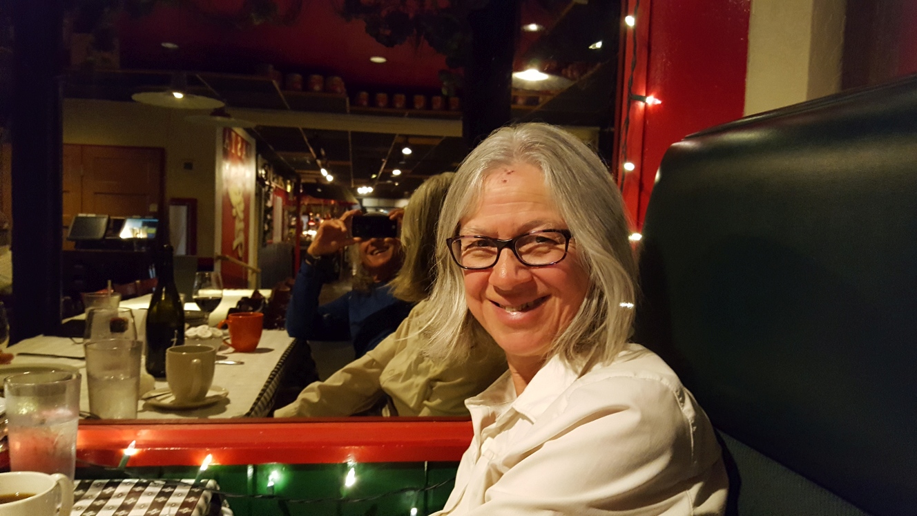 Melanie Celebrating Finishing at Tomato Brothers in Clarkston
Trails End September 7, 2016 Categories: Admin The only 3 people who have hiked the IBT (Mike O’brien, Yeti, & Melanie Simmerman) arrived at the start/end in Clarkston, WA today at 1:40 pm. What a thrill this is!! We got up early from our cozy camp on the Wahl’s land and headed out using the alternate road we were on. It was still pretty dark…5:30am start. As yesterday, today’s hike would be all roads (gravel and asphalt) except for the Lewiston/Clarkston bike path. More farmers fields planted with either wheat or garbanzo beans. It’s a golden sea of seemingly endless plantings. We watched one or two farmers out on huge machines tilling under the bits of wheat left from the harvest. They were preparing for the next planting. Clouds were lifting, though most of the morning remained a bit overcast. Sun broke out late morning. Gradually, we could see the beginning of the Clearwater River Valley – at first because of a huge cover of fog. We came to canyons and then big electric power lines. We followed a paved road that finally went steeply down and that led to our pathway to Lewiston. As we got down to the highway (95), we crossed first the southbound lanes, got into a truck weigh station, then crossed the northbound lanes to access the Lewiston bike path. It followed the Clearwater River, very industrial mostly, passed a paper plant and along the highway. Not to much landscaping here and no shade, but at least they have this path on the water. We got some relief by buying cold drinks at a convenience store which you pass after a couple of miles. Shortly after, we crossed over the river and started to anticipate the end. Once the Blue Bridge which crossed into Clarkston came into view, we were almost there! Poor Yeti, his pack was causing problems today — he had to take most of the weight on his shoulders and his back was hurting. He was ready to be at the end. Mike, Yeti and I got to the Blue Bridge and took pictures at the end. Then, Yeti and I joined hands and followed the short trail down to the sign that marks the beginning and end of the IBT. We were so grateful to be there – it had been a tough haul, especially for Yeti. By hook or by crook we had been determined that he and I would finish no matter what—and we did. Hallelujah! After a short rest and picture taking session, we stumbled on to the Motel 6 which is very close by and got our rooms. We cleaned up and had our celebration dinner at the Italian restaurant, Tomato Bros., right next to the motel. They have very good food. The end of these journeys always seems a bit rushed and we all scatter: Mike had a morning bus back to Boise and we had planned to go by bus back to Bozeman (a lengthy and disjointed trip with transfers and many stops). I felt a little dazed. This is the first long distance trail where I was totally relieved for the end. It had been kind of stressful, wondering if Yeti’s health would hold up. He had to rely on pills to help stave off water retention which would bring on congestive heart failure, and he did have to take a nitroglycerin on several occasions. But, we finished this trail and it is a huge accomplishment for us and I’m happy that Yeti and I did the final 900 miles together…it meant a lot to both of us. Yeti and Mike should be very proud to have put together this route that takes you through so many different landscapes and small Idaho Towns. Piecing it all together was no small feat. Bravo to both you guys! And, many thanks to the trail angels, towns people, people who gave us rides or helped in the medical emergencies, and the trail studs from Goose Lake who helped us along the way! We could not have done it without you. You made our trip unique and special. Thank you all. Yeti and I both feel rejuvenated by the kindness and goodness we experienced along the way. Happy Trails. Melanie