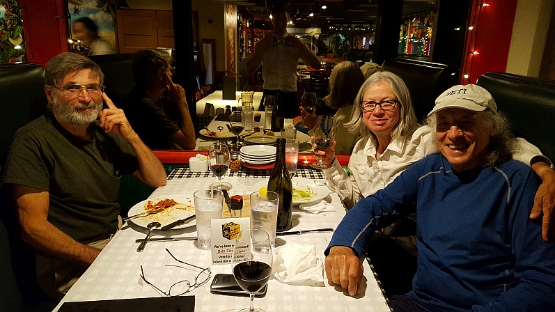
 Mike, Melanie, & Yeti Celebrating Finishing IBT
Check out these essential hiker guide’s for treks on the Pacific Northwest Trail (PNT) and the Idaho Boundary Trail (IBT), a hiker created route of 2,540 rugged miles circumnavigating the state of Idaho. Authored by seasoned thru-hikers, the guides will help hikers as they plan their trips and be critical on trail and in towns for easy re-supply. The Idaho Boundary Trail Hiker’s Guide provides an overview of this newly created route which was pieced together with existing trails, forest service roads, roads, and bushwhacks. The town guides offer critical information about resources in towns such as lodging, restaurants, grocery stores, outfitters and town maps to facilitate the town experience. While the books were written initially with long-distance hikers in mind, car touring visitors will also find them useful as they explore these out of the way places in the Pacific Northwest. All of the books are available for purchase on Amazon in paperback and Kindle versions. The Pacific Northwest Trail Town Guide is a great companion to Tim Youngbluth’s Pacific Northwest Trail Digest and Pacific Northwest Trail Data Book. Authors: Jim “Yeti” Fulmis, Thru-hiker and co-creator of the IBT Mike O’Brien, Thru-hiker and co-creator of the IBT Melanie Simmerman, Triple Crown Thru-hiker
Pacific Northwest Trail Town Guide
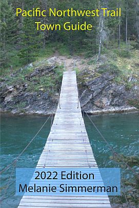
Author: Melanie Simmerman
Idaho Boundary Trail Hikers Guide
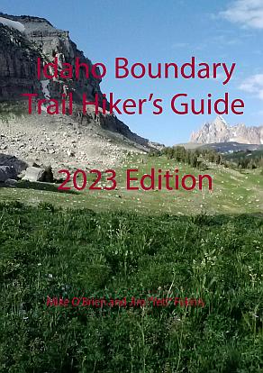
Authors: Mike O'Brien, Jim "Yeti" Fulmis, Melanie Simmerman
Idaho Boundary Trail Town Guide
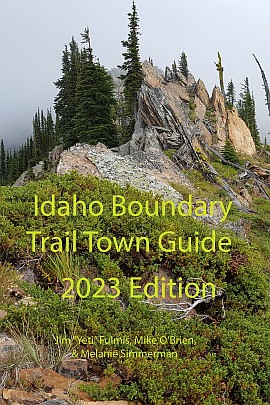
Authors: Jim "Yeti" Fulmis, Melanie Simmerman, Mike O'Brien
Pacific Northwest Trail Journals
The Pacific Northwest Trail (PNT) extends 1,200 miles from the Continental Divide in Glacier National Park to Cape Alava on the Pacific Ocean. The trail wends its way through the Rocky Mountains, the Selkirk Mountains, Pasayten Wilderness, North Cascades, Olympic Mountains and Washington’s Wilderness Coast. While hiking the PNT, you will travel through three National Parks and seven National Forests. Characterized by high mountain views and dramatic valleys, the Pacific Northwest Trail offers a rugged backcountry experience. Conceived by trail visionary Ron Strickland in 1970, the PNT was designated as a National Scenic Trail in 2009. The PNT, however, has yet to be fully completed on the ground. The trail is largely unmarked, so you can expect to be challenged by route finding and bushwhacking. The Pacific Northwest Trail Association is the non-profit with the mission to protect and promote the Pacific Northwest National Scenic Trail (PNNST), and to enhance recreation and educational opportunities for the enjoyment of present and future generations. For more information about the trail and hiker resources go to www.pnt.org. Yeti did the PNT in 2010 but at Ross Lake Resort in Washington with only 460 miles to go my right knee finally gave out after hiking 12,000 miles bone on bone. I was forced to come out and I got a full knee replacement and returned on the same calendar day and finished the hike in 2011. It just continued on in the same journal. Melanie was working full time so she had to do the PNT in sections 2012, 2013, 2014, & with Yeti in 2015. I hadn’t seen anything of the Olympic Mountains since it snowed or rained every day while I hiked through in 2011 so I wanted to see them. Yeti's PNT 2010 Journal: http://www.trailjournals.com/yeti2010 Melanie's PNT 2012 Journal: https://www.trailjournals.com/journal/13559 Melanie's PNT 2013 Journal: https://www.trailjournals.com/journal/15082 Melanie's PNT 2014 Journal: https://www.trailjournals.com/journal/17304 Melanie's PNT 2015 Journal: http://www.trailjournals.com/melaniepnt2015 I didn’t do a separate journal for 2015, Melanie did hers for both of us.
Continental Divide Trail Journals
The Continental Divide Trail (CDT) is one of the most ambitious of our National Scenic Trails. Ranging from 4,000 to 14,000 feet, the CDT passes through a variety of ecosystems from tundra to desert. Hikers can expect to see a variety of wildlife – grizzlies, elk, mountain goats, and deer – and hosts of wildflowers carpeting its remote mountain meadows. For the long-distance hiking community, the CDT is one-third of the “Triple Crown,” and approximately 150 ambitious travelers attempt to complete a thru-hike each year. Parts of the CDT are still in the planning phases, so expect to bushwhack incomplete sections or walk the roads. When completed, the trail will extend 3,100 miles from Mexico to Canada. Yogi’s planning books are highly recommended (http://www.yogisbooks.com). For more information, go to the Continental Divide Trail Coalition’s website at www.continentaldividetrail.org. Melanie (Lemstar) Simmerman & I (Yeti) both were hiking the Continental Divide Trail (CDT) in 2009 separately but met in Grand Lake Colorado. She was the first hiker I had seen on the trail after hiking through New Mexico and Colorado. We actually started hiking together when we met up again in Encampment, Wyoming. We did split up for awhile in South Pass City, WY but rejoined in Salmon, Idaho and finished the hike together. You can visit both our trail journals below: Yeti's CDT 2009 Journal: http://www.trailjournals.com/yeti Melanie's CDT 2009 Journal: https://www.trailjournals.com/journal/8532
Pacific Crest Trail Journal
The Pacific Crest Trail (PCT) spans 2,600 miles from the U.S. border at Campo, Mexico to Canada, wandering through desert, High Sierra pinnacles, rugged Cascade mountain ranges and remote meadows. Thru-hikers may encounter snow in the high mountains and swift-moving streams to ford, making a PCT journey both exhilarating and challenging. Yogi’s planning books are highly recommended (http://www.yogisbooks.com.) For more information, go to the Pacific Crest Trail Association’s website at www.pcta.org. I hiked this as a thru hike in 2007 & a little more than half in 2006, then the rest in 2008 but I didn’t do journals either of those years So I have done it twice but only once as a thru hike. This is a great trail to do as a first time thru hike. You can view the journal below: Yeti's PCT 2007 Journal: http://www.trailjournals.com/journal/6433
Idaho Boundary Trail Journals
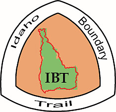
For More Info: IDAHO BOUNDARY TRAIL (IBT) Forging your own path: Creation of the IBT The Idaho Boundary Trail is 2,500 mile backcountry adventure (if you stick to the “main” route) and was conceived by Yeti and his friend Mike O’Brien in 2012. Affectionately known as the two geezers (they are both older hikers), Yeti and Mike planned the route by studying maps and satellite photos, hiking the route, and tracking it using a GPS. They painstakingly put together a route that would adhere as closely to the border of the state as possible. Idaho is unusual in that its perimeter is mostly public land, affording the hiker a wealth of varied landscapes to explore. The trail zig-zags back and forth across the border, seeking out the most interesting sights. The IBT is not an official trail and is not supported by any non-profit or state or federal agency. It is the inspired creation of two long-distance hikers who wanted to have a pure wilderness experience and to “hike their own hike.” Over the next few years, Yeti and Mike refined and changed the IBT as necessary to avoid private property, and to correct routes that were impassable. In some cases, they developed alternate or easier routes that give the hiker choices based on his/her abilities or desire for challenge. They like to call the really monster sections, the “geezer routes,” because the two of them hiked them. They have kept them as the main route. Easier paths are offered for those who are not up to the geezer challenge. Yeti and Mike decided to start the trail in Clarkston, WA and go counter-clockwise to get through the Owyhee Desert before it gets too hot and to make it through the Selkirks before snow flies up north. Yeti, a seasoned long-distance backpacker, has hiked the Pacific Crest Trail (PCT), Continental Divide Trail (CDT) and the Pacific Northwest Trail (PNT) among others. He considers the IBT to be even more of a challenge than any of these other trails, because large sections of the IBT are unmaintained, unfinished, and just downright rugged. But, for those who enjoyed “embracing the brutality” of the CDT, it is the next step up, and a magnificent 2,500 mile journey. Mike O’Brien & I (Yeti) created the Idaho Boundary Trail (IBT) and first started hiking it in 2012. I had to drop out due to severe sun stroke that year but Mike did the entire hike. In 2013 I (Yeti) hiked 1750 miles of the IBT but tripped hiking at night & ended up with a serious concussion. It took me two days o hike out vomiting and seeing double, but I got out. Mike hiked the IBT again in 2014. Then, in 2016 I finally finished the trail with Melanie Simmerman (Lemstar). Melanie did the entire trail in 2016. You can visit the trail journals below: Mike O’Brien’s Idaho Boundary Trail Journal 2012 Yeti’s Idaho Boundary Trail Journal 2013 Mike O’Brien’s Idaho Boundary Trail Journal 2014 Mike's's IBT 2012 Journal: http://www.trailjournals.com/idahoccw/ Yeti's IBT 2013 Journal: http://www.trailjournals.com/yeti2013 Mike's's IBT 2014 Journal: http://www.trailjournals.com/ibt2/ Yeti's IBT 2016 Journal: http://www.trailjournals.com/yeti2016 Melanie's IBT 2016 Journal: http://www.trailjournals.com/melanieibt2016